| Ref: Alan Kane's
Scrambles
in the Canadian Rockies |
|
 |
|
|
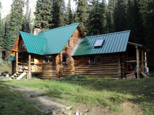
Stanley Mitchell
Hut, the trail is behind on the right.
|
| Scramble: RT
11.75 (including Whaleback Mountain); 5.0 up. The weather
forecast for sunday and monday deteriorated so we decided to cancel our
planned overnight trip. Since we were prepared for a long outing, we
thought a trek in the Little Yoho would be a good alternative. We
figured we would try Isolated Peak first and if the weather permitted,
we would exit via Whaleback Mountain. We got to the trailhead fairly
early and hiked up to Stanley Mitchell Hut at a decent pace; it took us
2 and a half hours. As we got there, two fellows we'd seen earlier at
the parking lot were leaving the hut. Fab and I looked at each other:
was that Marko Stavric? We set off in a different direction without
saying anything. We found out later that it was him; shoot, it would
have been nice to meet him... The steep trail quickly led us to
treeline. We continued in the draw and crossed the creek before the
waterfalls. Still on a trail, we proceeded to make our way to the toe
of the glacier and the ascent gully. We had no trouble picking out the
proper gully but getting to it was tough. Travelling
on the steep moraine and ledges proved challenging
due to the hard-packed ground; on several occasions, we had to kick
steps in the slope in order to get some purchase. It wasn't comforting
to think about trying to stop a slip on that section... Once at the
gully, a couple of moves on steep rock lead to easier ground. We
quickly gained the summit ridge and followed it to the top with no
difficulty. We didn't linger as the weather seemed to be moving in. On
our way to the gully, it started to drizzle. It intensified as
we backtracked lower down, we decided to take shelter against a big
boulder with an overhang. At some point, the rain was horizontal but
that was short lived; the sun came out and the clouds lifted. This
amazing "sucker hole" lured us into continuing up Whaleback Mountain. |
|
 |
|
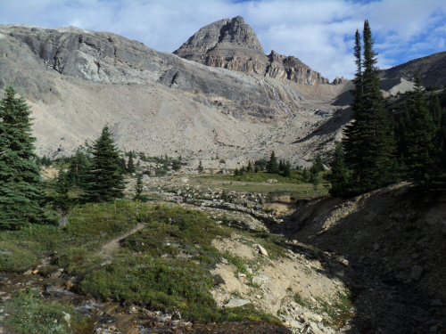
Reaching treeline
with Isolated Peak in sight. |
|
 |
|
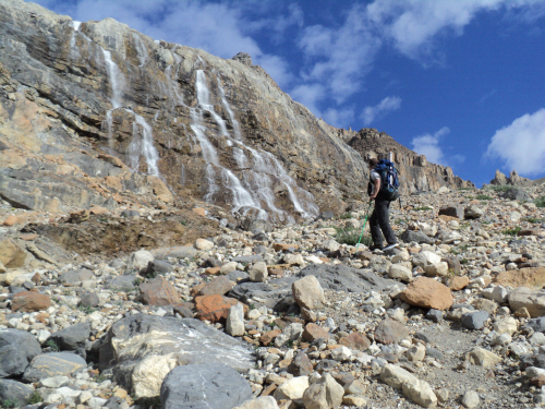
Nice waterfalls
along the way. |
|
 |
|
|
Looking back at The
Presidents, we crossed the creek where it braids. |
|
|
 |
|
|
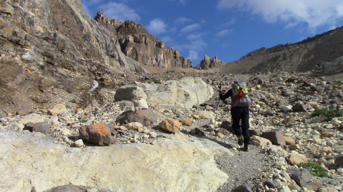
Nearing the back of
the draw. |
|
|
 |
|
|
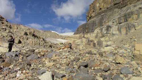
At the foot of
Isolated, a trail continues left of the snowpatch. |
|
|
 |
|
|
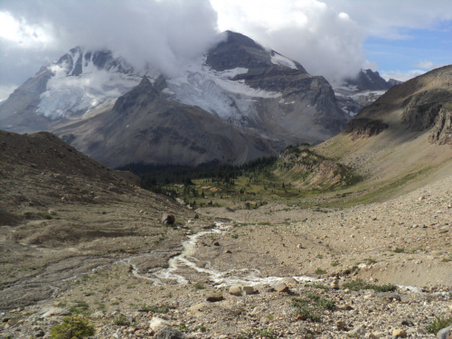
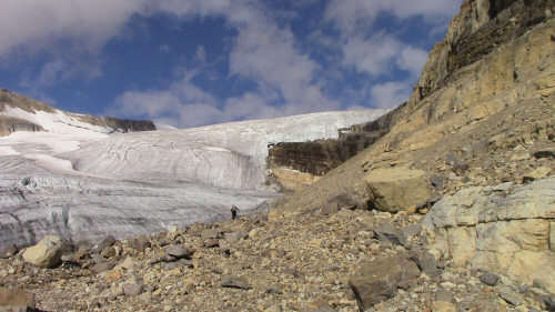
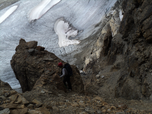
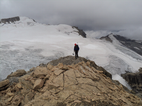
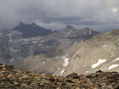
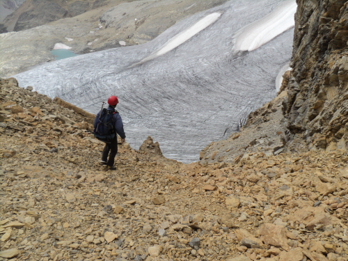
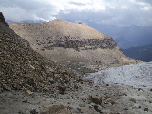
Heading towards
Glacier des Poilus. |
|
|
 |
|
|
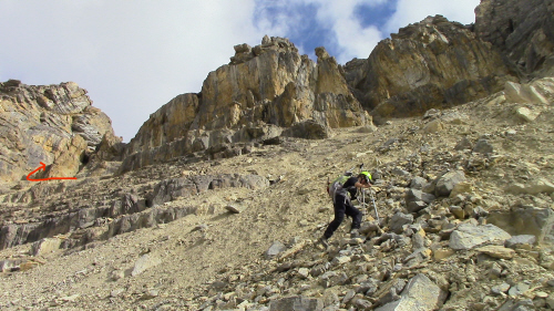
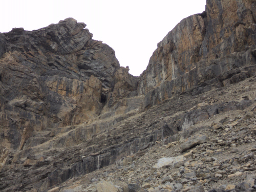
Aiming for the gully
climber's left. |
|
|
 |
|
|
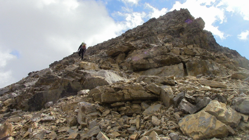
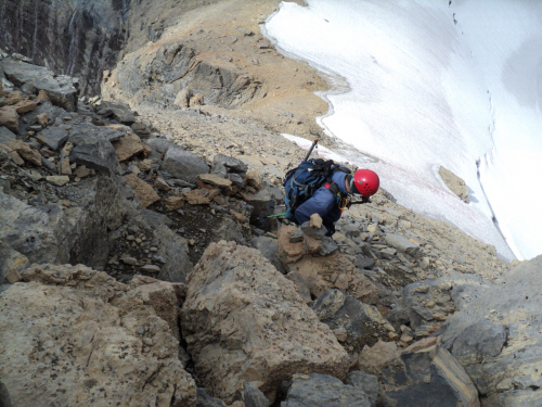
Climbing the ascent
gully. |
|
|
 |
|
|
Looking back again. |
|
|
 |
|
|
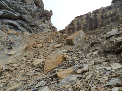
The remainder of the
gully is easy. |
|
|
 |
|
|
Gaining the summit
ridge. |
|
|
 |
|
|
Last stretch to the
top. |
|
|
 |
|
|
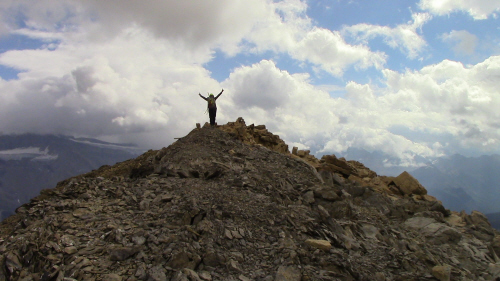
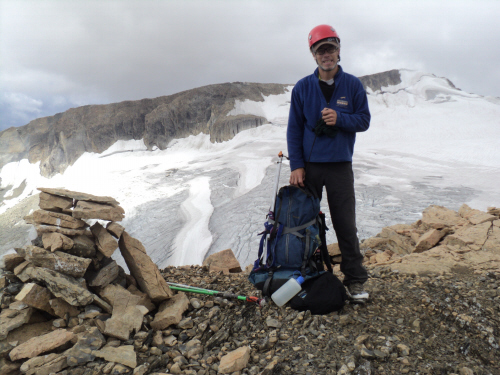
The summit cairn,
yippee!!!!!!! |
|
|
 |
|
|
The weather is
moving in behind Mount McArthur. |
|
|
 |
|
|
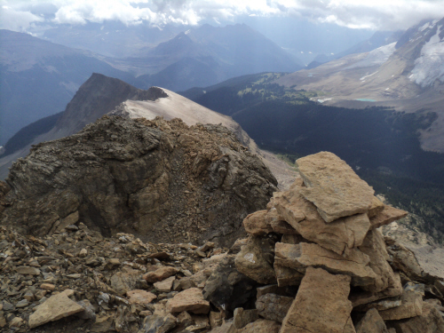
Whaleback Mountain
south-east of us. |
|
|
 |
|
|
To the south, Mount
Marpole is engulfed in cloud. |
|
|
 |
|
|
Northern view, Mont
des Poilus has totally disappeared. |
|
|
 |
|
|
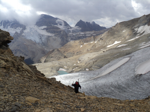
After a brief stay,
we're ready to head back down. |
|
|
 |
|
|
As we near the
approach gully below, it starts to drizzle. |
|
|
 |
|
|
Down the gully. |
|
|
 |
|
|
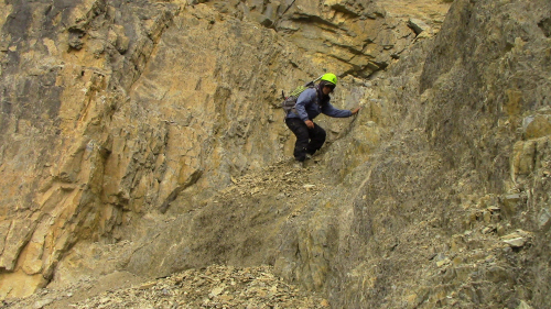
It's steeper at the
bottom of the gully. |
|
|
 |
|
|
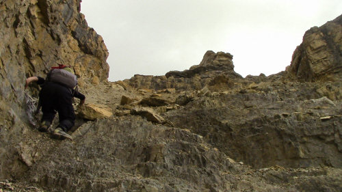
Backtracking on the
ledges. |
|
|
 |
|
|
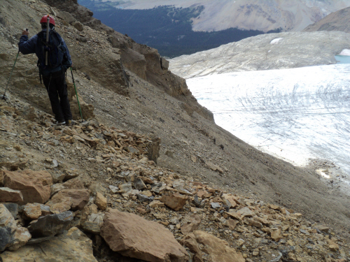
Last glimpse at the
gully. |
|
|
 |
|
|
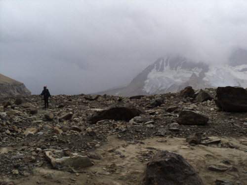
Not sure if we'll be
exiting via Whaleback Mountain. |
|
|
 |
|
|
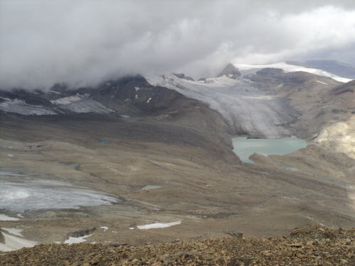
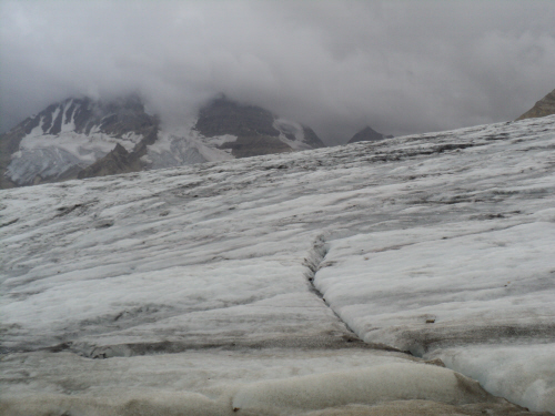
The Presidents
beyond the glacier. |
|
|
 |
|
|
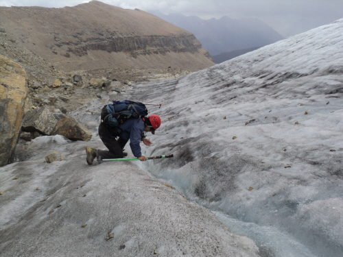
Cold, crisp water. |
|
|
 |
|
|
We took shelter by a
huge boulder with an overhang lower down. |
|
|
Continue
on to Whaleback Mountain |
| Back
to home page |
|
|