| Find the
Kindersley-Pinnacle FSR on the east side of highway 95, 16.5 kilometers
north of Radium. Follow the well-used gravel road, staying left at
the 7 kilometer marker, 628241 (ignore the Kindersley FSR to
the right). Just past the 15 kilometer marker, go right.
Continue for nearly 10 kilometers to the Diana Lake trailhead, 540352.
Hike the popular trail to Mount Norman's major south facing avalanche
path, 550366, about 2.5 kilometers from the trailhead. The slide path
directly leads to the east ridge and summit with no difficulty.
Variations through the upper bluffs seem to be possible. ***Try to time
your trip so you can take advantage of the remaining firm snow!***
|
|
 |
|
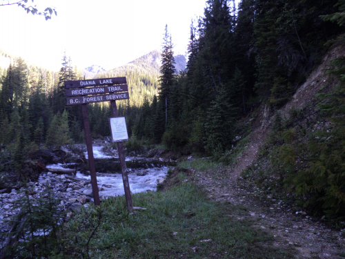
Diana Lake trailhead. |
| Scramble:
RT
7.0; 3.25 up. Once again, we
weren't too sure what would be the outcome of this outing. The only
information we found was a trip report from Rick Collier but we were
planning an entirely different route. Our goal was to hike the trail
that heads to Diana Lake for a couple of kilometers and simply go up
Mount Norman's major south facing avalanche path; we hoped the gully
would be filled with firm snow at some point. Our drive in was
uneventful; the service road has potholes but otherwise it is in decent
shape. We parked at the trailhead and casually hiked on the trail.
There is a bit of deadfall on the popular trail but it's manageable.
In less than an hour, we reached the recognizable run out zone of the
slide path we came to ascend. We were thrilled to see it filled with
old
avalanche debris its whole length! We felt very lucky, 750 meters of
height gain on continuous snow meant a delightful ascent and an insane
glissade!!! Still, there was no guarantee we would reach the summit. We
had a quick break as we put on our crampons. Climbing the firm snow was
consistently great. The grade of the gully was perfect; although it
seemed very steep near the top, we didn't feel the need to use our
alpine axe. As we neared the crest of the east ridge, we veered
climber's left, ascending more snow slopes. To our surprise and
disbelief, as soon as we stepped off the snow, the cairn appeared. Wow,
how sweet is that! While Fab checked for a register, I ventured on the
other summit to the south, just minutes away. After rejoining with Fab,
we had
lunch; the weather was fine, the view fantastic. The ascent and summit
stay were very enjoyable, coming down the mountain was even better! The
descent was truly one of the best glissades I've experienced. The
conditions were excellent and the lengthy snow run did not disappoint;
I
laughed and yelled the whole way back down to the trail! I really
recommend this trip; short and very sweet! |
|
 |
|
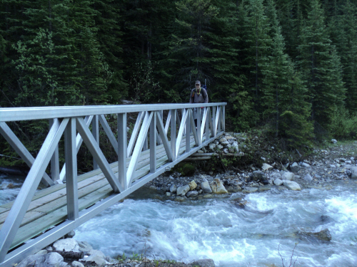
A nice aluminium
bridge at the start. |
|
 |
|
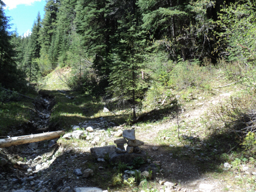
The trail leaves the
old road and heads east along the foot of Mount Norman. |
|
 |
|
|
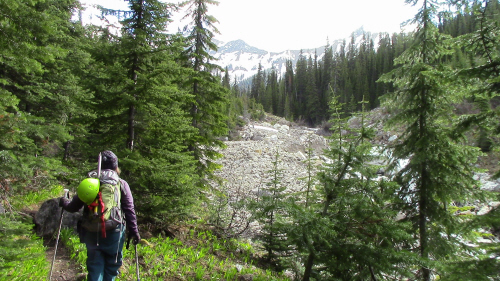
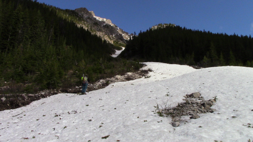
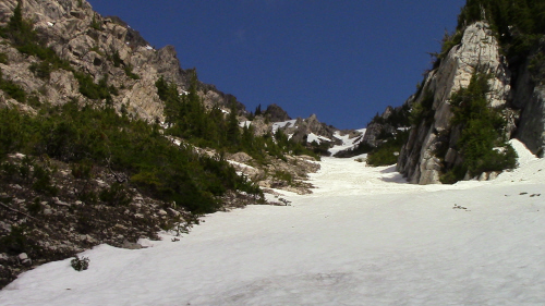
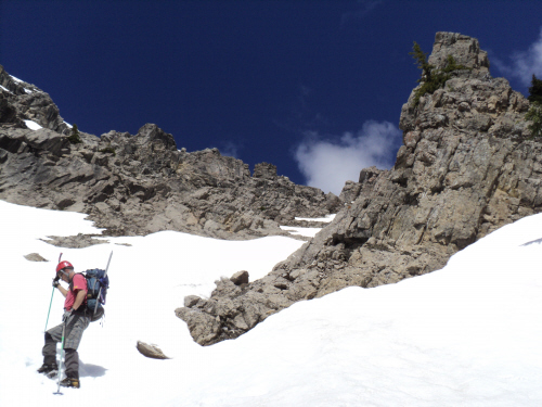
Nearing our ascent
gully. |
|
|
 |
|
|
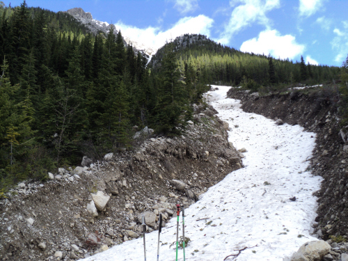
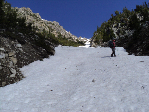
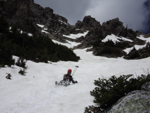
The major slide path
is filled with firm snow from the trail to the ridge crest! |
|
|
 |
|
|
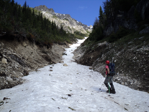
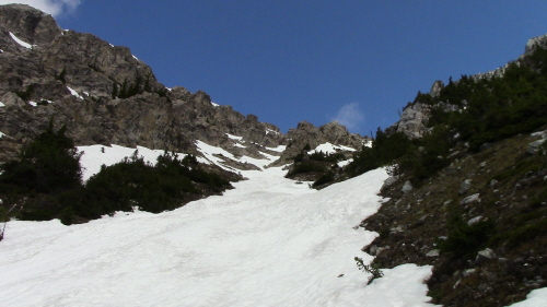
Starting up 750
meters of height gain on continuous snow. |
|
|
 |
|
|
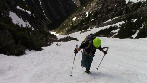
The ascent is quite
delightful, as good as it gets. |
|
|
 |
|
|
I'm all smiles. |
|
|
 |
|
|
More of this awesome
snow gully. |
|
|
 |
|
|
Getting close to the
ridge crest. |
|
|
 |
|
|
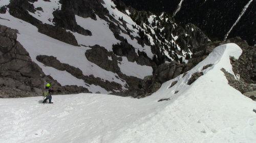
Aiming for the snow
in the middle. |
|
|
 |
|
|
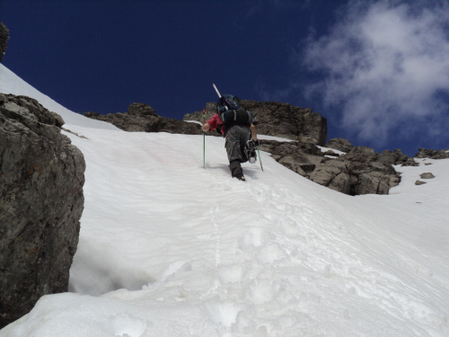
Great conditions for
kicking steps. |
|
|
 |
|
|
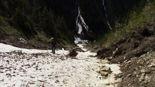
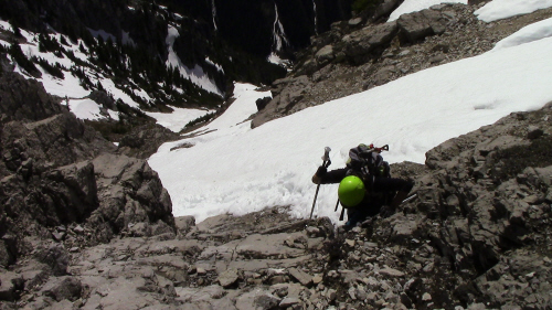
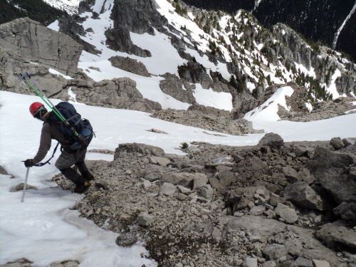
Making our way
around bluffs. |
|
|
 |
|
|
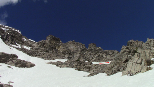
The route we chose
is indicated with an arrow. |
|
|
 |
|
|
Shortcut on some
rock. |
|
|
 |
|
|
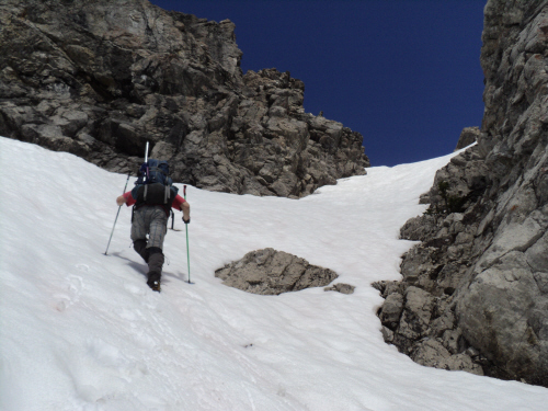
Climbing more snow! |
|
|
 |
|
|
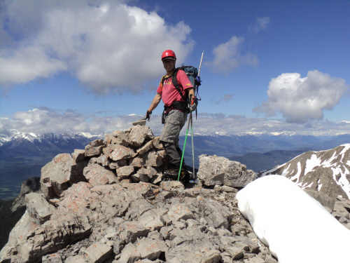
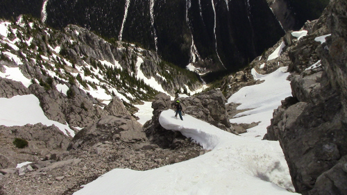
A few minutes away
from the top. |
|
|
 |
|
|
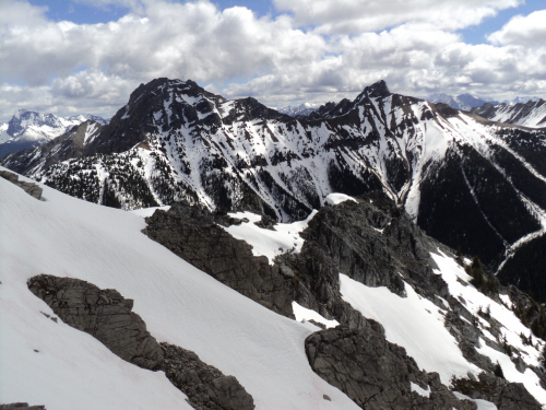
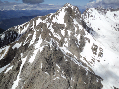
The view beyond
Mount Norman's east ridge. |
|
|
 |
|
|
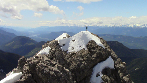
The cairn appears as
we step off the snow. |
|
|
 |
|
|
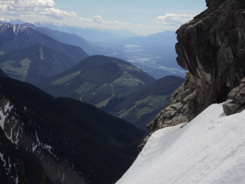
The west side of the
Columbia Valley. |
|
|
 |
|
|
Norman Ridge to the
north. |
|
|
 |
|
|
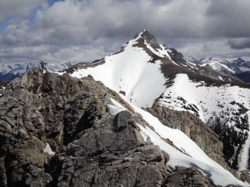
A quick jaunt to the
neighboring peak. |
|
|
 |
|
|
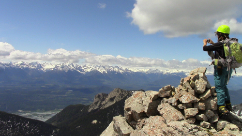
Fab poses with The
Judge in the background. |
|
|
 |
|
|
A nice unnamed peak
to the south. |
|
|
 |
|
|
Time to head down. |
|
|
 |
|
|
Fun and fast. |
|
|
 |
|
|
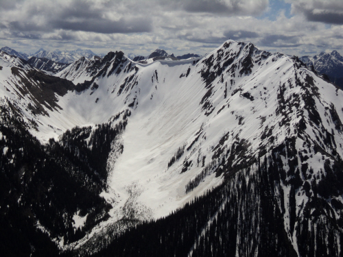
The gully is
visible, it runs all the way down to valley bottom. |
|
|
 |
|
|
Columbia Valley to
the south. |
|
|
 |
|
|
One of the best
glissades ever!!! Click on the picture to see a short movie. |
|
|
 |
|
|
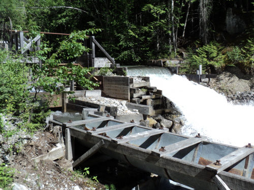
Operational aqueduct
along the service road. |
| Back to home page |
|
|