Drive
west
past Golden on highway 1. After crossing the
Columbia River on the Donald Bridge, start your odometer, the trailhead
is 9.5 kilometers away. If you forget, you can calculate 3.8 kilometers
from the Donald FSR. The trailhead is on the west side of the highway
and dips down; it is extremely hard to find. It is just after a set of
concrete barriers and delineators (on the opposite side). If you reach
a rest area on the east side, you missed it! After
turning and dipping down, park at the flat area,
814041. Quad or bike the 9-kilometer service road to the last landing,
808989. If you decide to
use an ATV, a washout needs to be negotiated about 2 kilometers in.
From the parking area, you will come to a newly built road (West
Bench Trail), go left. Follow the road for less than 400 meters and
start looking for the not so obvious access road that starts to climb
on the right (more like straight ahead); this road eventually skirts
Oldman Creek. From the last landing, hike through minor bush and slide paths
until you reach boulder slopes on a mountainside. Skirt the boulder
field then aim to follow the drainage; we lost a bit of elevation to
avoid sidehilling. Continue towards the col south-west of Donald Peak,
828966. Blocky terrain leads to the false summit. We encountered minor
drops along the connecting ridge to the true summit; moderate
scrambling on
the southern side of the ridge can be expected.
|
|
|
|
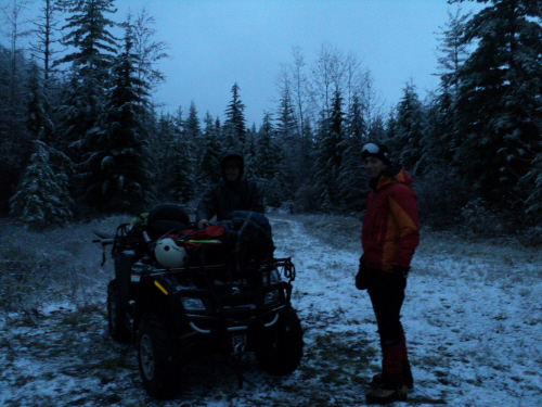
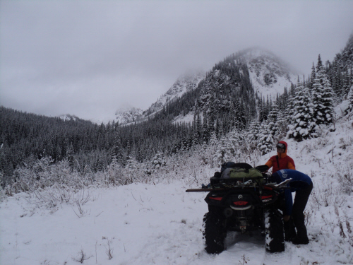
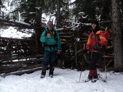
Preparing for a
9-kilometer ride.
|
|
 |
|
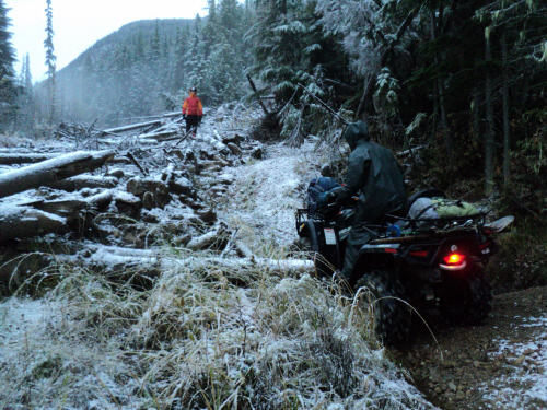
The
washout at kilometer 2, is easily negotiated.
|
|
 |
|
|
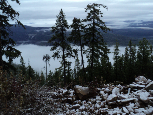
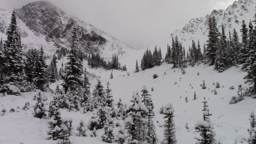
Typical
valley fog at this time of the year. |
Scramble: RT 8.25; 4.75
up (from the landing). Following a long stint of stable weather,
conditions deteriorated
in time for
sunday. We decided to forego a planned trip in K-Country for a local
objective; we advised Charles. To our surprise, he called us on
saturday to tell us he was on his way to Golden to join us despite the
poor weather and long drive from Calgary. We prepared for the worst
and brought rain gear. We set off in the morning, driving through snow
squalls and reached the access road under an hour. Fab unloaded the ATV
and strapped our packs, a wrecking bar, a saw and a shovel to it; you
never know, better safe than sorry... We proceeded without mishap to
the last landing. Fab and I recalled an
earlier trip this way on our bikes; gotta admit, quading was much more
enjoyable and appropriate for this time of the year. After a short
bushwhack, we made it to the boulder slopes on the mountainside. We
skirted the boulder field then continued along the drainage until
treeline; from there, the col wasn't
far but snow depth increased. Once at the col, we veered
towards our objective and tackled blocky terrain to the false summit.
The true summit was in sight, we tried to stay close to the broken
ridge crest but big blocks and minor drops offered some challenge; we
circumvented obstacles on the southern aspect.
We carefully made our way across the ridge and were greeted by a big
cairn at the top. Pleased with the outing, we took pictures and stayed
for a while to enjoy the view and relatively nice weather. I looked for
the benchmark but there was too much snow to move around. We carefully
backtracked to the col and meandered to the quad finding a shelter
along the way. Using an ATV made this trip feasible during the shorter
autumn days; it was a nice prelude to winter!
|
|
 |
|
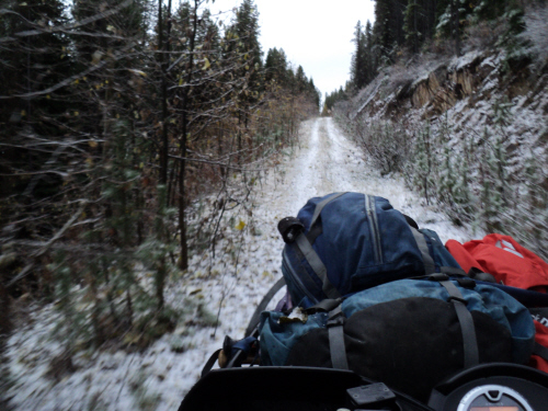
Much
easier and faster than biking!
|
|
 |
|
We
have company...
|
|
 |
|
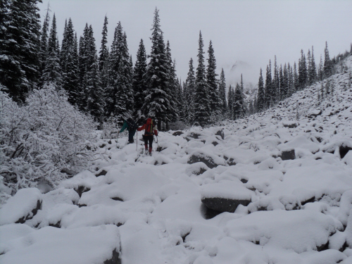
At the landing, we
left the ATV and aimed for the boulder slopes (center).
|
|
 |
|
Skirting
the boulder slopes.
|
|
 |
|
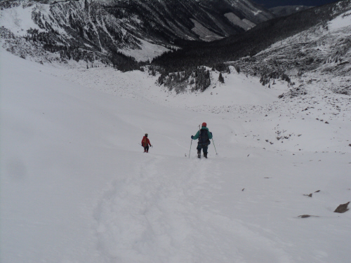
Pleasant
trekking along the drainage.
|
|
 |
|
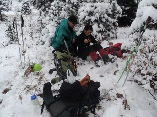
Changing
the units on Charles' new GPS.
|
|
 |
|
|
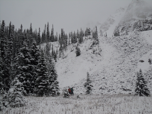
Donald
Peak's false summit on the left.
|
|
|
 |
|
|
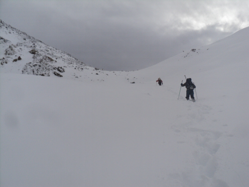
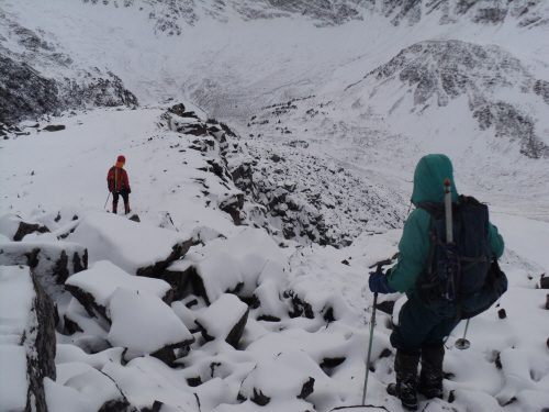
The
snow is deeper as we progress towards the col.
|
|
|
 |
|
|
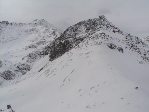
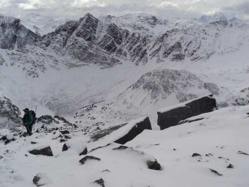
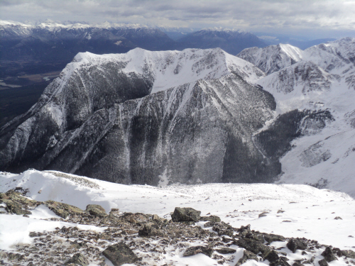
Oldman
Peak (left) and its connecting ridge.
|
|
|
 |
|
|
Nearing
Donald Peak's false summit.
|
|
|
 |
|
|
Looking
back.
|
|
|
 |
|
|
Donald's
true summit ahead.
|
|
|
 |
|
|
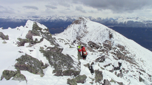
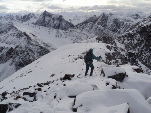
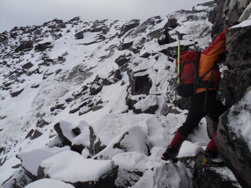
A
couple of tricky spots along the ridge crest.
|
|
|
 |
|
|
The
top is minutes away.
|
|
|
 |
|
|
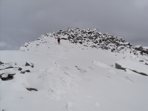
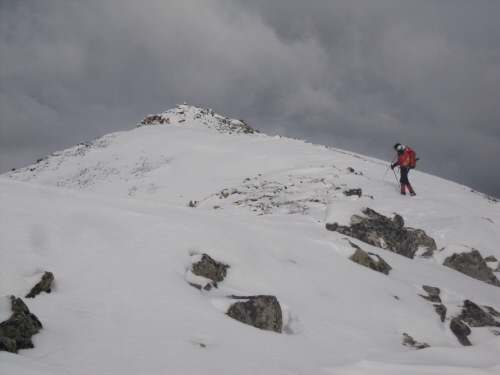
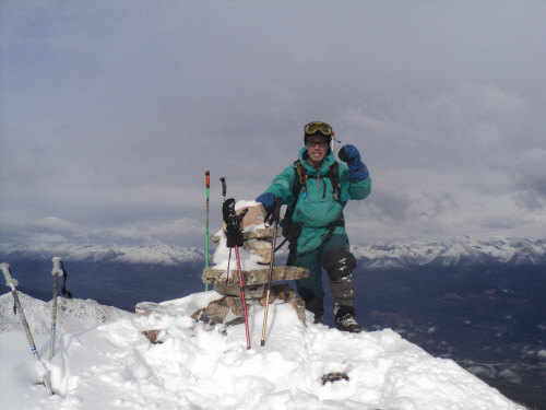
Donald
Peak is dotted with a big cairn.
|
|
|
 |
|
|
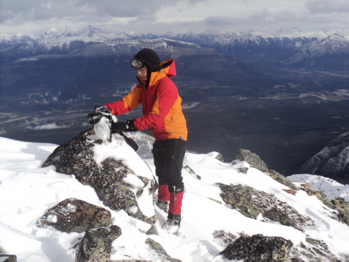
Charles
sets his camera with the Columbia Valley in the background.
|
|
|
 |
|
|
The
town of Golden is hidden by this unnamed peak.
|
|
|
 |
|
|
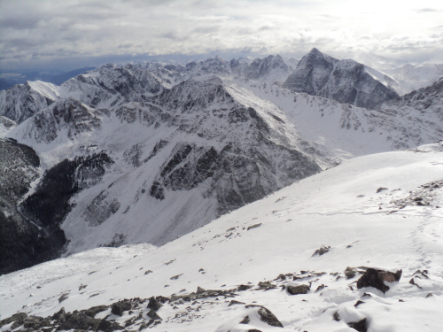
The
tall mountain on the right is named Kingpin Peak.
|
|
|
 |
|
|
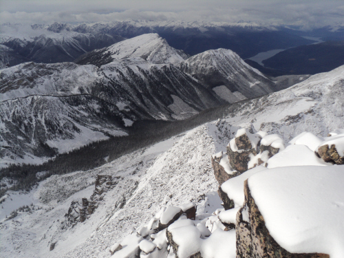
The
cutblock where we left the ATV (center) and Kinbasket Lake.
|
|
|
 |
|
|
Leaving
the top.
|
|
|
 |
|
|
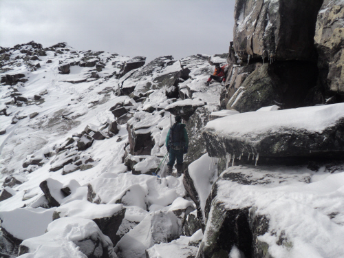
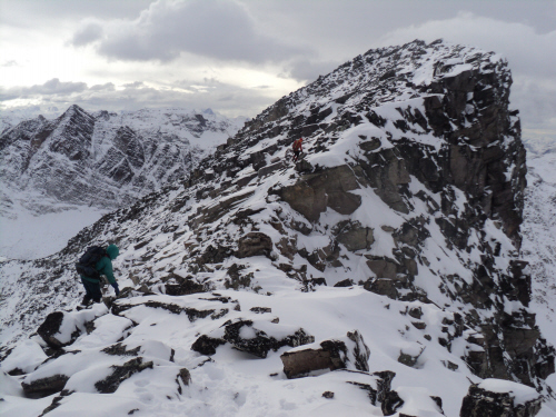
Travelling
on blocky terrain.
|
|
|
 |
|
|
Some
sections are entertaining.
|
|
|
 |
|
|
More
blocky terrain to the col.
|
|
|
 |
|
|
Swooshing
back to treeline.
|
|
|
 |
|
|
We
found a shelter while returning.
|
| Back
to home page |
|
|