Park at the Gorman
Lake trailhead, 892877 and follow a well-defined trail to Gorman Lake,
described in Golden
Hikes.
Hike around the lake, the south shore is quickest and continue into the
draw veering climber's right. Aim for the grassy slopes heading towards
the col, 853885. Traverse and contour into the drainage to
a small meadow and creek, 837895. From there, gain the rib climber's
left of a waterfall and head south-east. Stay
on the rib and go climber's left of the glacier to easily attain the
summit ridge. Slabs impede progress to the top via the ridge, traverse
below the slabs on the south-west slopes to a saddle on
the
ridge. Although there is a cairned summit to the south, the true summit
is
minutes away to the north, 846885.
Name note: a bokor is a sorcerer, good or evil, worker of Voodoo
(ref: Bivouac). |
|
 |
|
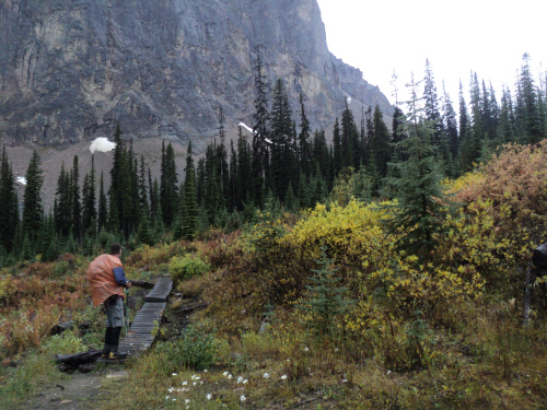
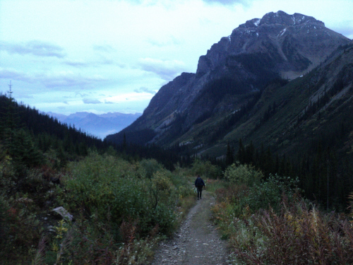
A nice trail heads
to Gorman Lake. |
|
 |
|
|
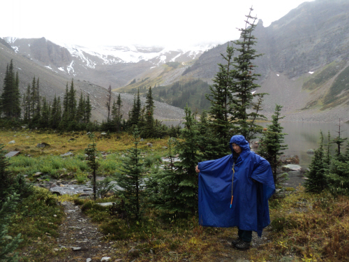
At the lake, the
drizzle continues. |
| Scramble: RT
11.25; 6.0 up. We chose a local
summit in the vicinity of Gorman Lake to
celebrate our 250th scramble. It had been a while
since our last visit, 6 years. The weather forecast predicted rain so
we
left home prepared with rain gear and extra layers. The outing to Bokor
is long (21 km
return)
but straightforward, we left the truck as the darkness subsided. The
drizzle didn't dampen our spirits, we were happy to be back to this
area, Golden's gem. Within an hour, we reached the lake. Our objective
was engulfed in clouds. We followed the good trail around the lake then
started random hiking towards the col. Hiking was pleasant
despite the rain but as we neared the col, the wind picked up. We
stopped and changed our layers. The wind driven rain was partially
snow, we continued into the rocky drainage careful not to
slip. To our surprise, the clouds lifted and the rain ceased. The long
traverse on talus led to the grassy ascent slopes used to gain
Bokor's north-west aspect. We were thrilled to see the glacier below
the
summit ridge; access to the ridge would be easy climber's left of it.
Once on
the ridge, we felt uncertain about reaching the top; the ridge becomes
slabby forcing a traverse on the south-west slopes. Maybe we could gain
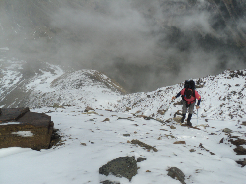
it from the south side... At this point, Fab slipped and twisted his
knee; after a moment, he was able to stand. The situation could be
serious, should we turn around? Fab decided he could keep going slowly.
After circumventing the slabs, we climbed back to the summit
ridge. I quickly scrambled the cairned southern peak but Fab was
convinced the summit was in the other direction, above the slabs.
Indeed, from the south summit, the northern highpoint is taller. I
returned
to the saddle on the ridge and we ascended towards the highpoint. As we
neared it, a cairn revealed itself. Yeah, we made it... our
250th scramble!!!! The view of the familiar mountains is awesome, we
were lucky it cleared up. The clouds added interest but the wind was
vicious. We had to brace ourselves to be able to stand next to the
cairn on the edge of the summit ridge. With no shelter, we soon engaged
in a hasty retreat. Fab's knee was sore but stable, we descended to a
rock outcrop for a good pause. After eating, drinking and taking
ibuprofen,
we regained the summit ridge and dropped back down the north-west side.
The wind calmed down as we retraced our way back to the long traverse.
We were fortunate it wasn't raining, navigating the blocky terrain was
good. By 6 PM, we stood on the col again; it was all downhill from
here. We soon stepped
onto the good trail by Gorman Lake. The pace accelerated as we raced
back to the truck. We arrived with less than half an hour of daylight
left. What a fulfilling day! We are very pleased with this local
trip and glad to have chosen it for this milestone. |
|
 |
|
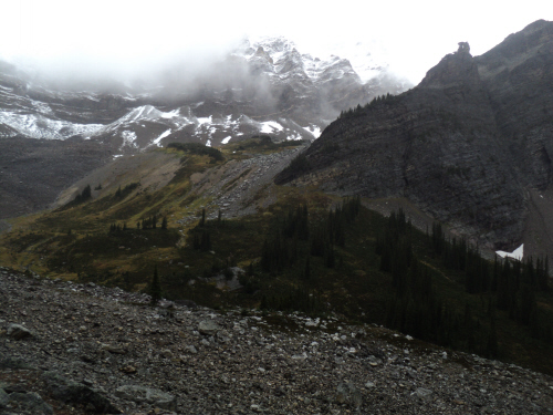
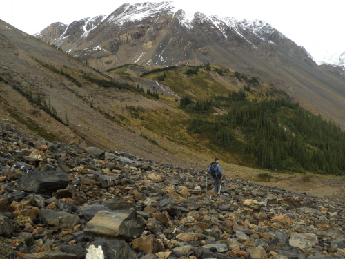
Our objective is
partly visible.
|
|
 |
|
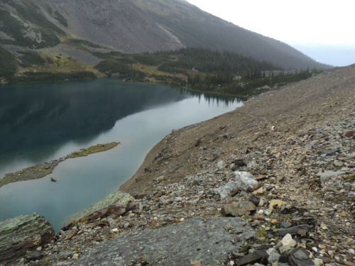
Looking back at
beautiful Gorman Lake. |
|
 |
|
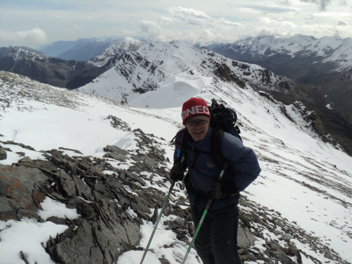
Going up the grassy
slopes. |
|
 |
|
|
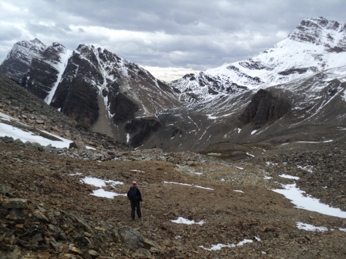
The col
ahead, Bokor Peak on the left. |
|
|
 |
|
|
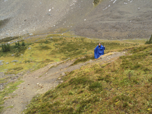
The wind picks up, a Marilyn Monroe moment. |
|
|
 |
|
|
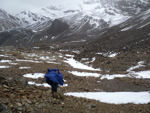
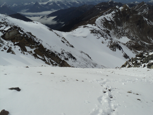
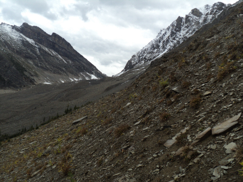
A long traverse on
talus into Lang Drainage. |
|
|
 |
|
|
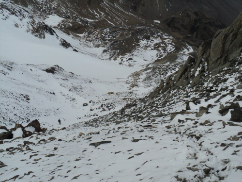
Aiming for the small
meadow and creek. |
|
|
 |
|
|
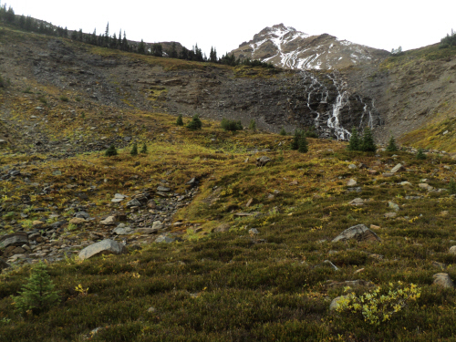
Going left of the
waterfall. |
|
|
 |
|
|
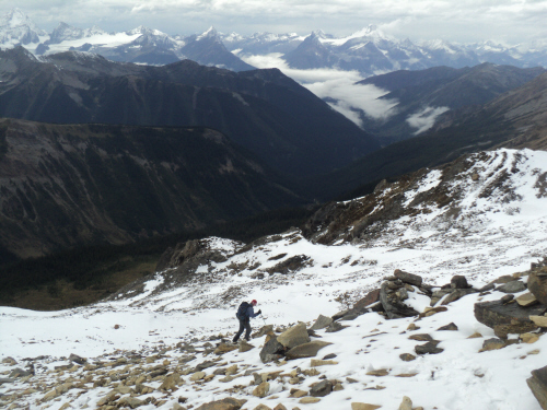
Heading south-east
towards the glacier. |
|
|
 |
|
|
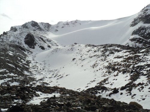
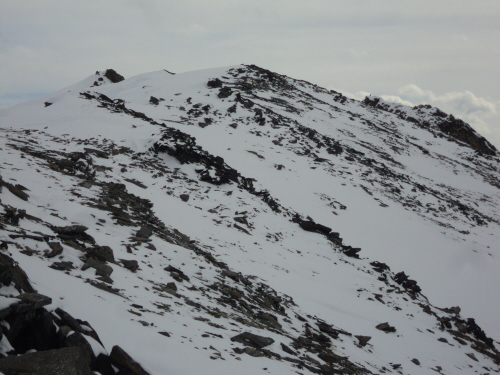
Nearing the glacier
and summit ridge. |
|
|
 |
|
|
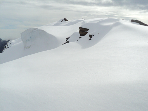
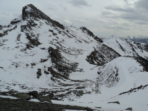
The clouds lift for
this nice picture, the route goes left of the glacier. |
|
|
 |
|
|
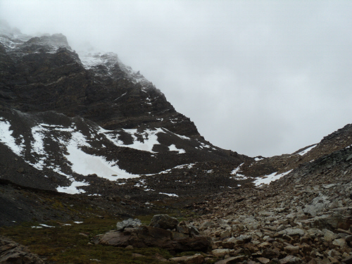
The clouds return. |
|
|
 |
|
|
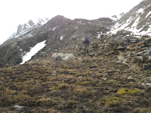
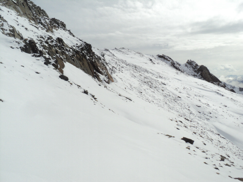
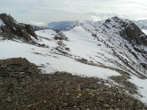
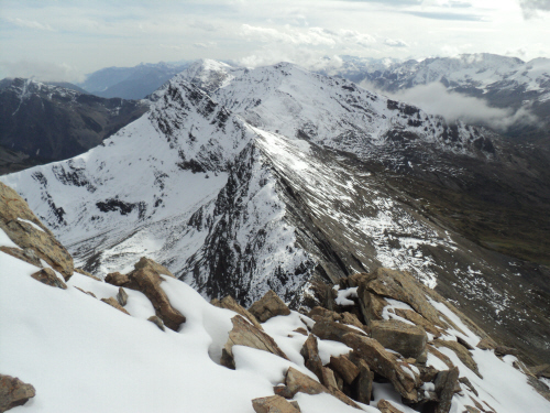
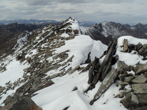
On the summit ridge,
slabs can be avoided on the south-west slopes. |
|
|
 |
|
|
Skirting the slabs
to a saddle further on the ridge. |
|
|
 |
|
|
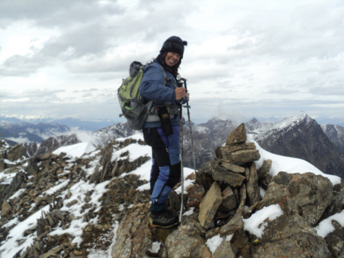
A cairn exists on
the southern peak, I decided to investigate. |
|
|
 |
|
|
On the ridge. |
|
|
 |
|
|
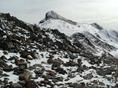
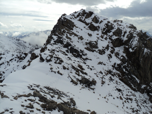
The southern peak is
not far. |
|
|
 |
|
|
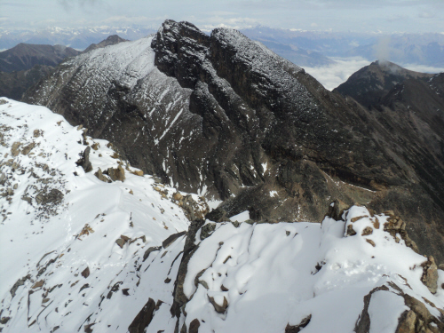
At the top, Zombie
Peak in the background. |
|
|
 |
|
|
Dawn Mountain to the
south-east. |
|
|
 |
|
|
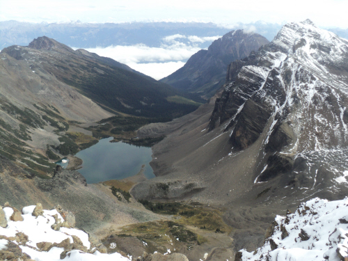
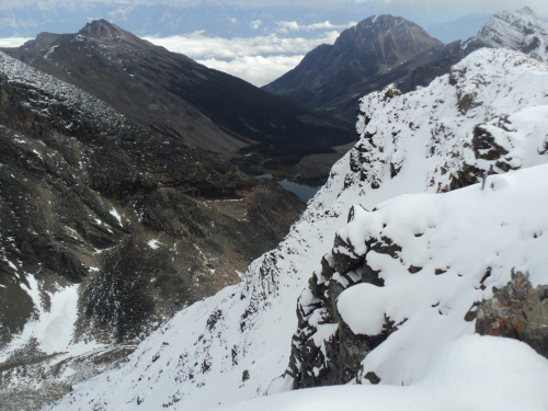
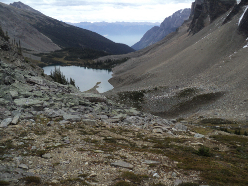
The best view of
Gorman Lake with The Clamshell (right of center) and Eos Peak (right). |
|
|
 |
|
|
A good glimpse back
at the southern summit. |
|
|
 |
|
|
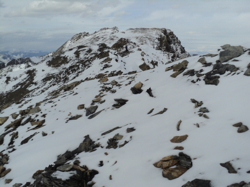
Rejoining Fab for
the last steps to the true summit (center). |
|
|
 |
|
|
Summit cairn just
ahead. |
|
|
 |
|
|
Sweeeeeet, a very
special local outing! |
|
|
 |
|
|
Our 250th
scramble!!!!!!! Candy smile!!!!! |
|
|
 |
|
|
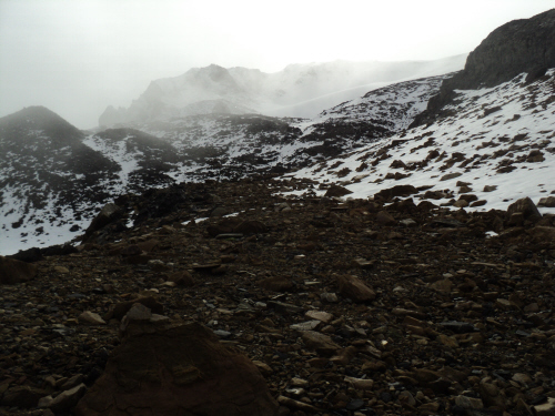
Gorman Lake is
partly obstructed from this viewpoint; nice valley fog. |
|
|
 |
|
|
Time to leave and
find shelter. |
|
|
 |
|
|
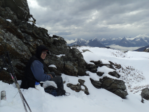
Ah, hot chocolate
and ibuprofen. |
|
|
 |
|
|
The glacier is on
the
other side of the ridge. |
|
|
 |
|
|
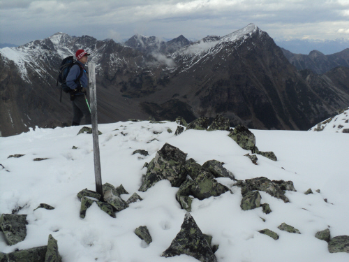
A marker at the top
of the ridge. |
|
|
 |
|
|
Glad mister bokor
was nice to us!!! |
|
|
 |
|
|
Exquisite scenery. |
|
|
 |
|
|
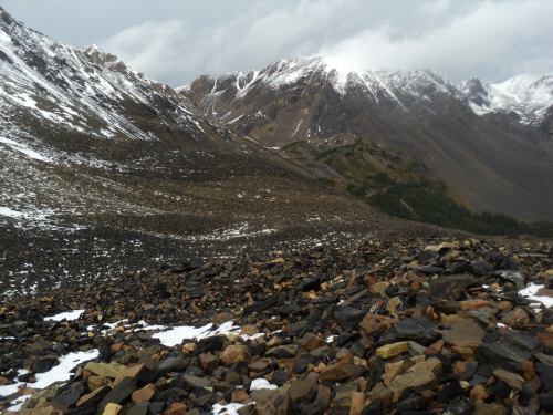
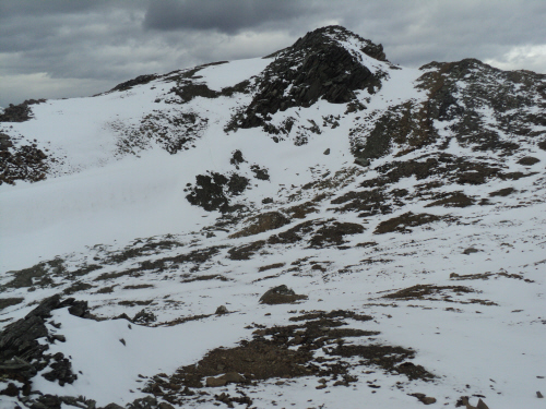
The whole approach
rib is visible. |
|
|
 |
|
|
Nearing the
waterfall with Kingpin Peak in the background. |
|
|
 |
|
|
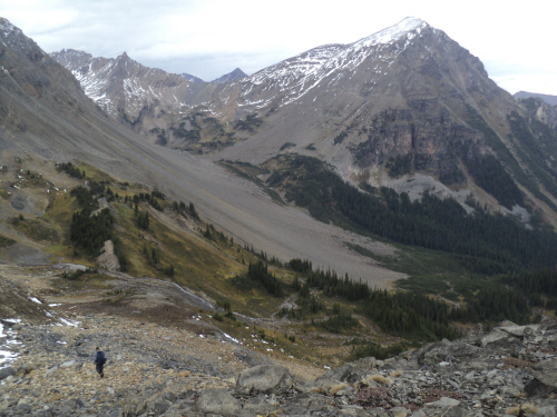
The drainage with
Zombie (left) and Bokor Peaks. |
|
|
 |
|
|
At the col by 6 PM,
Eos Peak on the left. |
|
|
 |
|
|
Back at the lake. |
|
|
 |
|
|
Almost there, just
before dark... |
| Back
to home page |
|
|