Ref: She Dreams of Alpine
|
|
|
|
|
4 AM start under the twilight.
|
Scramble:
RT 18.0; 10.0 up. Mount Whitney is the highest point in the
contiguous United States; it is probably one of the most sought-after
14ers. During the summer, it is very busy, and hikers must apply for a
permit through a lottery; however, no permit is required off-season. In
my opinion, attempting this objective early in November is the best
time; winter has no grip on the mountain, the Whitney Portal road is
likely in good condition, there’s no need to deal with the lottery, and
there are fewer hikers. Mount Whitney boasts several routes. The
mountaineering route is the most appealing way to reach the top for
scramblers, but the 22-mile trail is the route that hikers choose. The
non-technical trail can be completed in one long day, 12-16 hours,
depending on conditions; however, there are several locations along the
way to set up camp.
Milan and I wanted to attempt this objective in 2024, but we had to
change our plans. This year, we were finally able to drive down to Lone
Pine to tackle it. We decided to go in early November. During our
drive there, the weather was unstable, and it rained nonstop; luckily,
as we neared Lone Pine, we got a good weather window. The US
government was shut down, so we didn't have to pick up the free permit
required; after grabbing
expensive groceries, we proceeded to the trailhead. The portal road was
in great shape with no snow. We planned to attempt the objective in one
day. We slept in the car, getting up at 3:30 for an early start. We
hiked at a good pace, under the twilight, all the way to the outpost
camp. We didn't take long breaks until we reached the flats just before
the "99 switchbacks". The steep mountainside wasn’t free of snow; from
below, it was tough to see where the trail was. We sat in the sun and
enjoyed a good break before tackling the ascent. Shortly after starting the climb, we stopped to don our crampons.
We were glad to have them as the snow on the trail was wind-driven and
firm; in some places, caution was definitely required. A hiker informed
us about someone falling to his death at “the cables” a couple of days
ago. About midway, our pace slowed when Milan began to feel the effect
of high altitude. We were thrilled to reach the saddle on the ridge; we
took another quick break and removed our crampons. Following a short
descent, we reached the John Muir Trail junction, which descends the
west slopes towards Guitar Lake. We continued on the backside of the
ridge and Mount Muir; the trail was still snow-covered and way longer
than anticipated. By the time we cleared that part, Milan was suffering
from altitude sickness. The final stretch to the summit was easy, but
the pace was slow, and the wind had a bite. Eventually, we reached the
top, where we stayed briefly. While heading back down, Milan started to
feel better instantly. The timing was perfect, and we caught the sunset
as we traversed towards the 99 switchbacks. We didn't waste time
putting on the crampons for the steep descent; we wanted to get as far
down the switchbacks before dark. However, darkness fell upon us
quickly, and we had to negotiate “the cables” in the dark. Back down at
the flats, we stowed the crampons and continued in autopilot mode.
Returning was insanely long. I crawled for the last hour due to extreme
fatigue and blisters. When we arrived at the car, we just went to sleep
without eating. I was very happy with our accomplishment; this had been
a long day, but I wouldn't change anything.
|
|

|
|
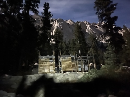
At the trailhead.
|
|

|
|
We are blessed with a full moon.
|
|
|
|
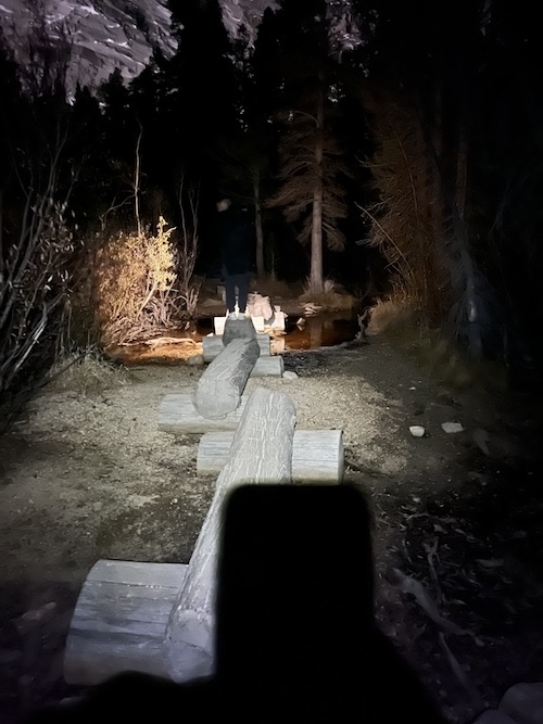
The log bridge that precedes the Outpost Camp.
|
|

|
|
Looking back, Outpost Lake is visible as dawn is upon us.
|
|

|
|
Nearing Outpost Camp.
|
|
|
|
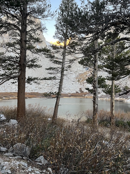
After Outpost Camp, Mirror Lake is craddled by steep slopes.
|
|

|
|
Leaving trees behind as we climb towards the high alpine cirque.
|
|

|
|
Looking back.
|
|

|
|
Consolation Lake comes into view.
|
|

|
|
We continue to Trail Camp.
|
|

|
|
Finally, some sun at Trail Camp after more than 4 hours of hiking.
|
|

|
|
Trading running shoes for alpine boots before the 99 Switchbacks.
|
|

|
|
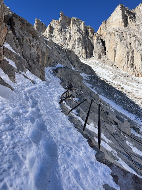
The snow is firm, crampons are required.
|
|
|
|
At The Cables.
|
|

|
|
A couple of days ago, a hiker slipped under the cables and fell to his death.
|
|

|
|
|
The snow adds hazard on the steep terrain.
|
|
|
 |
|
|
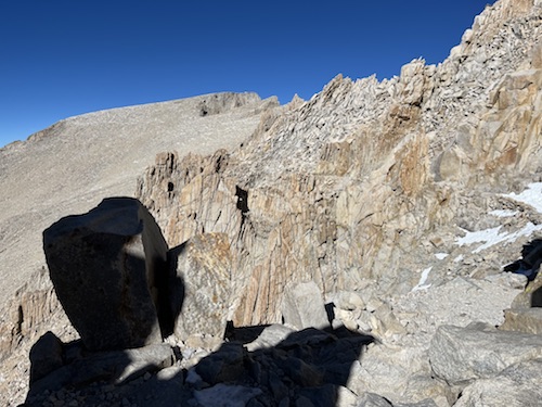
Getting closer to the ridge crest.
|
|
|
 |
|
|
Cresting on the ridge.
|
|
|
 |
|
|
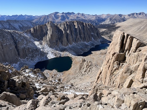
Hitchcock Lakes and Hitchcock Mountain unfold on the west side.
|
|
|
 |
|
|
The trail descends on the left of the gendarmes to join with the John Muir Trail junction.
|
|
|

|
|
|
JMT junction, we continue traversing towards the summit.
Picture courtesy of CaliforniaThroughMyLens.
|
|
|
 |
|
|
The trail on the backside is rocky and some sections hold snow.
|
|
|
 |
|
|
The final stretch is easy but longer than it seems.
|
|
|
 |
|
|
Looking back, the top of the 99 Switchbacks can be seen (center).
|
|
|
 |
|
|
Finally, the summit is a skip and a hop away!
|
|
|
 |
|
|
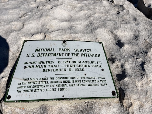
Summit plaque.
|
|
|
 |
|
|
Eastern view towards Lone Pine and Owens Lake on its right.
|
|
|
 |
|
|
Mount Langley (left) and Mount Pickering on the right, make up the southern view.
|
|
|
 |
|
|
The western view includes the Sequoia National Park.
|
|
|
 |
|
|
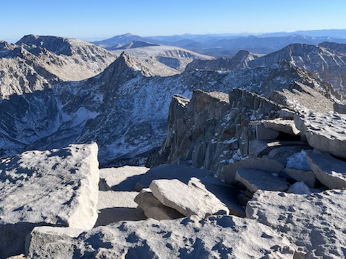
Mount Barnard (center), and Mount Williamson to the far right stand out to the north.
|
|
|
 |
|
|
Backtracking.
|
|
|
 |
|
|
It's already 4PM, the sun is low.
|
|
|
 |
|
|
The traverse on the backside of the ridge grants several windows onto the alpine cirque below.
|
|
|
 |
|
|
A guitar-shapped lake below bears its descriptive name.
|
|
|
 |
|
|
Interesting rock gendarmes along the backside.
|
|
|
 |
|
|
We're enjoying the view on this traverse
|
|
|
 |
|
|
Hiking under the warm glow of the setting sun.
|
|
|
 |
|
|
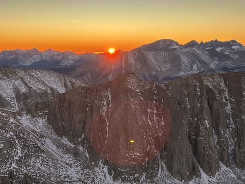
Glorious sunset before we reach the switchbacks.
|
|
|
 |
|
|
The moon rises over Lone Pine.
|
|
|
 |
|
|
Descending the switchbacks in the dark.
|
|
|
 |
|
|
Bye bye Mount Whitney, it was wonderful up there.
|
|
|
 |
|
|
Running shoes back on.
|
|
|
 |
|
|
Returning under the moon light.
|
| Back
to home page
|
|
|