Ascent: -North ridge class 2
Traverse: -The Notch to Notch Mountain Shelter class 3
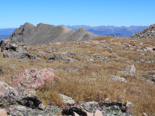
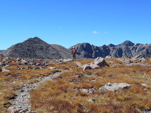
Scramble: RT 14.5 (includes Holy Cross Ridge and Mount of the Holy Cross); 2.75 up. Notch Mountain is an unranked 13er but is labeled on the topographic map; it's the first objective of the incredibly beautiful loop to Mount of the Holy Cross. Hiking this loop was an unexpected surprise and it turned out to be one of the highlights on my Colorado trip. The amazing Tour de Force requires great stamina and stable weather, Tim and I were fortunate to have both on this day! The 20+ kilometer loop travels over several highpoints, including 2 ranked 13ers (Point 13248 and Holy Cross Ridge) before reaching the prized 14er; it grants a fun class 3 scramble through The Notch and offers stunning scenery along the way with the best view of the cross on Mount of the Holy Cross. The whole loop has a combined height gain of 1,860 meters.
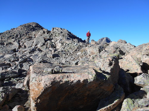
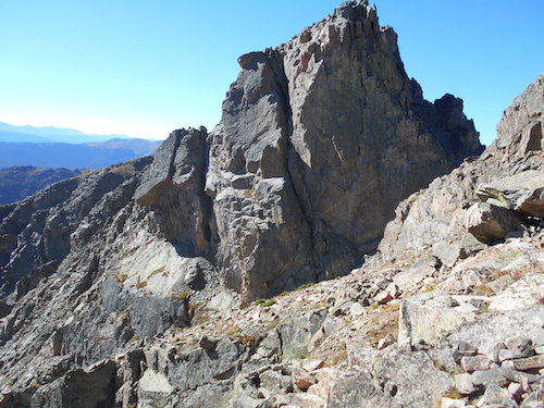
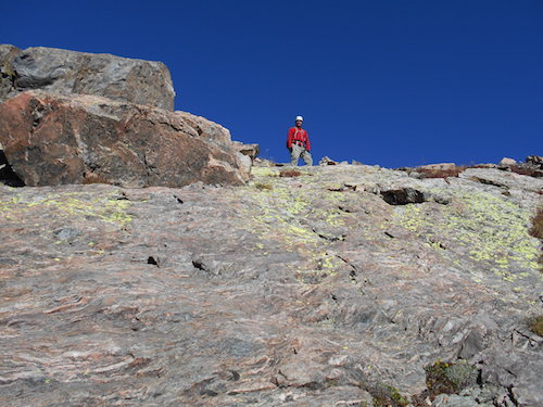
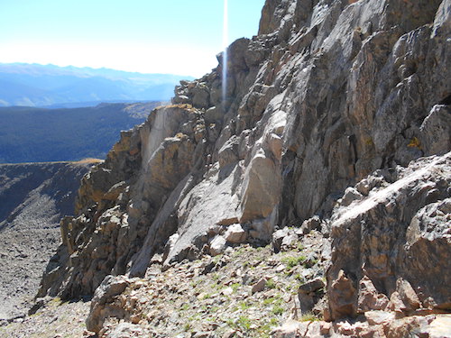
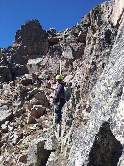
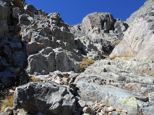
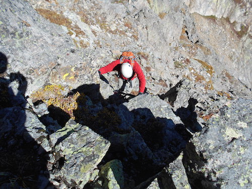
We left Leadville in the afternoon and drove to the Tigiwon Road, this long dirt road with numerous switchbacks leads to the Half Moon trailhead. We expected the campground at the trailhead to be full on this labour day weekend but it wasn't, we found a site, built a campfire and made supper; we retired for the night at a reasonable time. We left before dawn the following morning and reached Half Moon Pass by day break. We veered off the trail and started ascending talus slopes towards the summit of Notch Mountain. Random hiking through fair-sized rocks easily leads to the top, I didn't really try to find trail segments. We followed the summit ridge while taking in the fine views all around, it was the start of a great day! The sun really felt nice, there wasn't any clouds. When we reached the summit, we had a good break before tackling the connecting ridge towards Halo Ridge and the Notch Mountain Shelter. The section called The Notch grants good scrambling, a couple of routes of varying difficulty exist. From the top of Notch Mountain, we followed the ridge on its east aspect and made our way down to the gully separating the summit and the prominent highpoint to the south. We misread Roach's book description that clearly describes descending on the west side of the ridge shortly after leaving the summit and to scamper up ledges and talus slopes beyond The Notch (class 2+). That wasn't a problem, I had scoped out a line of ascent on the way down from the summit (class 3). I later found out, through research on the internet, that a difficult route also exists and starts from the saddle between the two summits, it follows a spine of broken ledges to an exposed step before gaining the ridge crest (class 4-5); it's an impressive route. Anyway, our route required descending in the loose gully to the narrow grassy ledge I had spotted from higher up. After convincing Tim that the route I had seen led to manageable terrain and a good way back up to the ridge, I went ahead. A short steep scramble got me to the narrow ledge where I visualized the terrain beyond, after that, I confirmed to Tim to come up. We then climbed the steep blocky mountainside to the ridge, I thoroughly enjoyed that section and found it to be quite a delightful scramble. Once back on the ridge, we casually walked to the Notch Mountain Shelter. The view of the cross on Mount of the Holy Cross is outstanding from the shelter, sadly there was no more snow in the couloir to accentuate the feature. We took a nice break to enjoy the scenery, bask in the sun and wind down from the scramble. We visited the nice shelter before resuming our trek along Halo Ridge.


Picture courtesy of Tim Best.

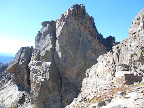

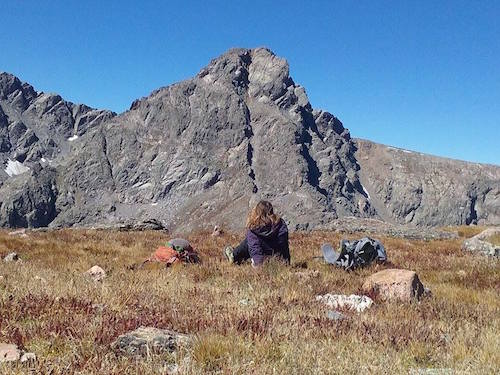
Aiming for the
route spotted from higher up.
Picture courtesy of
Tim Best.


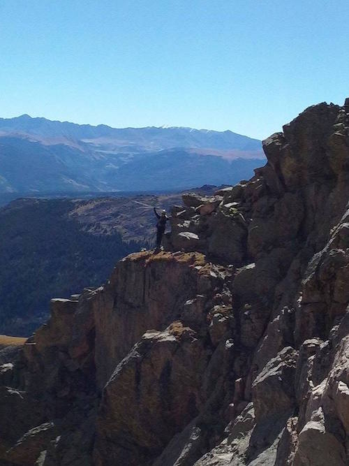
Picture courtesy of Tim Best.

Picture courtesy of Tim Best.


Picture courtesy of Tim Best.

Picture courtesy of Tim Best.
Picture courtesy of Tim Best.