| From
the Trans-Canada highway, turn south on the Beaverfoot Road and cross
the Kicking Horse River. Soon after going over the bridge, turn right
on Kicking Horse Road towards Chancellor Peak Chalets. Continue on this
road for 5.5 kilometers and turn left on Kapristo Spur Road, drive to
the landing and park, 195763; the road is in decent shape but that's
always subject to change... From the landing, skirt the cutblock to the
forest's edge. We travelled on the steep hillside in the forest for a
short distance before descending to the unnamed creek; we followed the
creekbed all the way to the basin east of Kapristo's summit block,
186737. In order to avoid impasses, we had to climb the western bank
and bushwhack through tight shrubs twice (only short detours). Although
travelling the creekbed is tedious, it's far better than the
alternative and it grants interesting hiking. Choose the right time to
go; early season, the creek might be a "no go"! Once in the basin, gain
the saddle south-east of the summit block and scramble the ridge
towards the objective. At the summit block, we climbed until finding an
obvious ledge system that crosses the northern face to easier terrain;
the scrambling wasn't too difficult and exposure was manageable. We
resumed the ascent to the southernmost peak and traversed the summit
ridge to the true summit which has a survey marker.
|
|

|
|
At
the landing, we went to the forest's edge at the bottom of the cutblock.
|
|
 |
|
|
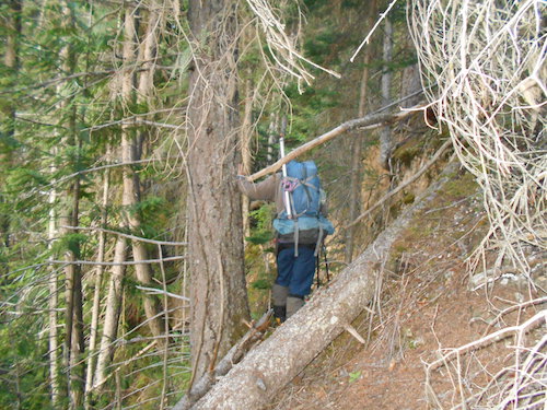
Steep sidehilling in
the forest, we're heading down to the creekbed...
|
| Scramble:
RT 13.0; 6.25 up. Kapristo Mountain is
the highest peak along the Beaverfoot Range, it has been a destination
I've wanted to explore for a long time. There was no information on the
internet other than Rick Collier's ascent from the south on a traverse
of that range. Our planned route up an unnamed creek was a
gamble, we weren't sure if the creek would land us in the basin where
we could ascend to the saddle south of the summit block. The best way
to find out was to go investigate and "take one for the team"! We drove
up on a decent road to the landing we had seen on Google Earth. From
there, we hiked the bushy clearing to the edge of the forest.
Travelling along the steep west bank of the creek wasn't easy, we soon
dropped to the creekbed hoping to find less resistance. To
our surprise, we were able to travel up the creekbed. Our progress up
the creek was slow, at times we had to negotiate tricky sections or
slimy slippery rock; amazingly enough, we were only required
to find a way up the west bank to circumvent difficulties in the
creek on two occasions. Those bypasses were not pleasant but
fortunately, they were short-lived... After 3.5 hours of perserverance
and tedious travel up the creekbed, the terrain opened up and we were
delivered in the basin east of the summit block. We were
thrilled, the ascent to the saddle appeared easy. We took a nice long
break before continuing. At the saddle, we left our poles and put on
our helmets; it looked like we'd be scrambling from there on. The ridge
offers fun scrambling and leads to the summit block where it gets more
challenging. We climbed the summit block a short distance before
finding a good place to
traverse the face onto easier terrain. The
scrambling was never too difficult and it looks like several options
are likely possible. After traversing, we continued
scrambling upwards to the southmost peak. We walked the summit
ridge over a false summit then onto the true summit which has a survey
marker. We were both elated to be standing at the top. We
had lunch before backtracking to the creekbed. The descent in the
creekbed was as long as we expected it to be, I even wiped out into
the creek banging a butt cheek pretty good and superficially submerging
my camera. Other than that, it was uneventful and we reached the truck
in good spirit. This scramble is certainly fun and interesting and the
access up the creekbed, although long, isn't that bad; I enjoyed it
despite the bruise!
|
|
 |
|
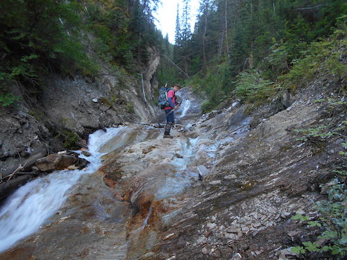
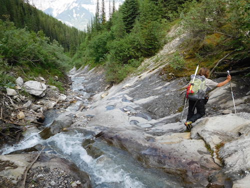
Finding
our way along the creekbed, this is actually interesting.
|
|

|
|
We're
travelling along the creekbed pretty much all the way to the basin.
|
|
 |
|
Kapristo's
eastern basin, whoohoo!
|
|
 |
|
|
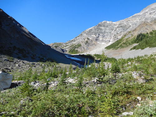
The
objective from the basin.
|
|
|
 |
|
|
Instead
of going to the low saddle, we aimed higher where the ridge meets the
flatter terrain (center).
|
|
|
 |
|
|
Delicate
snow bridges remain in the heat of summer.
|
|
|
 |
|
|
At
the saddle, preparing to scramble up the south-east ridge.
|
|
|
 |
|
|
Easy
and straightforward so far.
|
|
|
 |
|
|
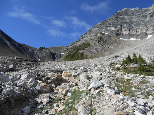
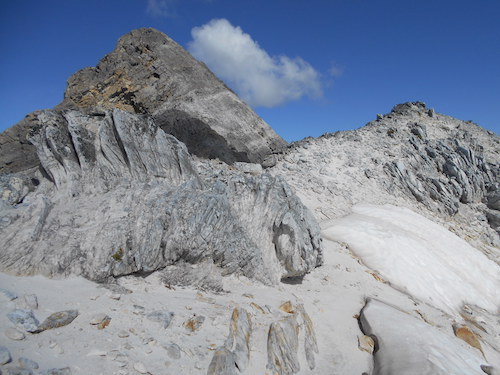
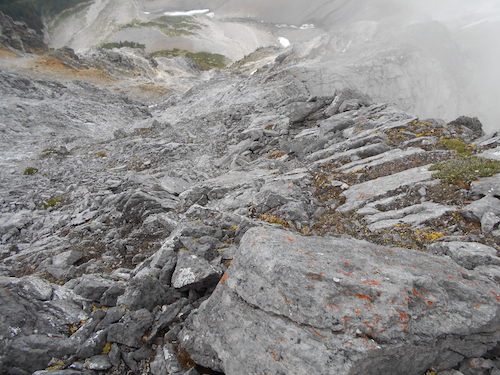
The
summit block comes into view beyond this beach-like pulverized rock.
|
|
|
 |
|
|
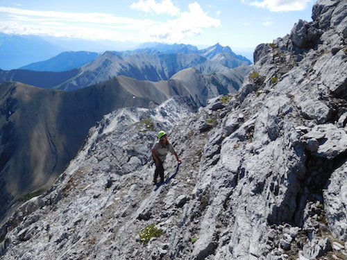
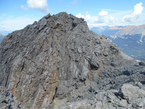
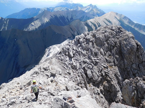
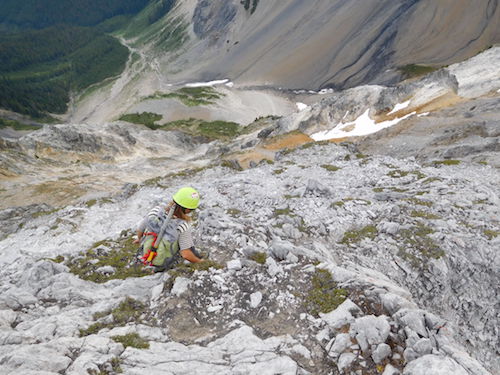
Scrambling
becomes moderate as we near the summit block.
|
|
|
 |
|
|
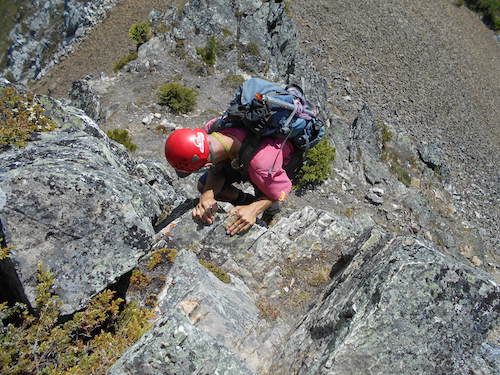
We
climbed the summit block and traversed the face to easier terrain.
|
|
|
 |
|
|
Climbing
the left side of the face before traversing.
|
|
|
 |
|
|
Traversing
on a decent ledge.
|
|
|
 |
|
|
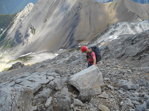
Odd
scrambly bit beyond the traverse.
|
|
|
 |
|
|
Ascending
easier terrain towards the southmost peak. |
|
|
 |
|
|
Looking
back.
|
|
|
 |
|
|
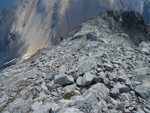
Fab's
coming up a gully as I wait on the summit ridge.
|
|
|
 |
|
|
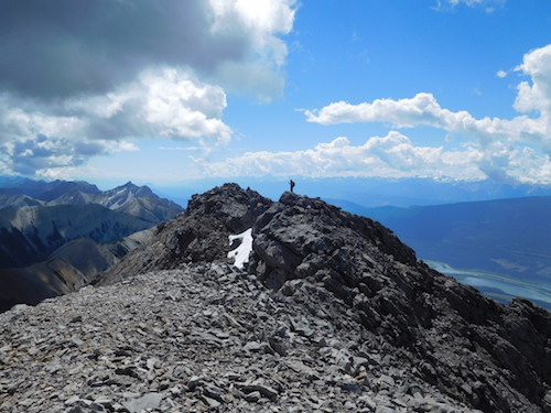
A
prominent false summit to go up and over.
|
|
|
 |
|
|
True
summit in sight, damn.
|
|
|
 |
|
|
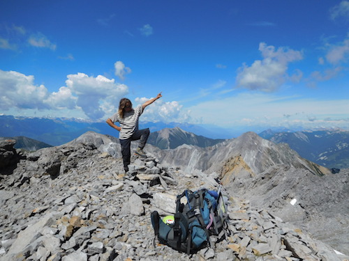
Oh
ya!!!
|
|
|
 |
|
|
It's
official.
|
|
|
 |
|
|
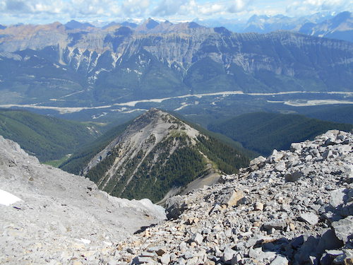
Looking
north-east over the Kicking Horse River towards Mount Hunter.
|
|
|
 |
|
|
Western
view over the Columbia Valley towards Glacier National Park.
|
|
|
 |
|
|
Rick's
name in the register, thanks for the inspiration, RIP...
|
|
|
 |
|
|
Mount
Vaux (left), Chancellor Peak (left center) and The Goodsirs towering
beyond (right center).
|
|
|
 |
|
|
Heading
back.
|
|
|
 |
|
|
The
Beaverfoot Range to the south.
|
|
|
 |
|
|
Retracing
our steps to the traverse.
|
|
|
 |
|
|
Back
on the ledge.
|
|
|
 |
|
|
More
of the same.
|
|
|
 |
|
|
Fab's
looking back as I'm traversing the ledge.
|
|
|
 |
|
|
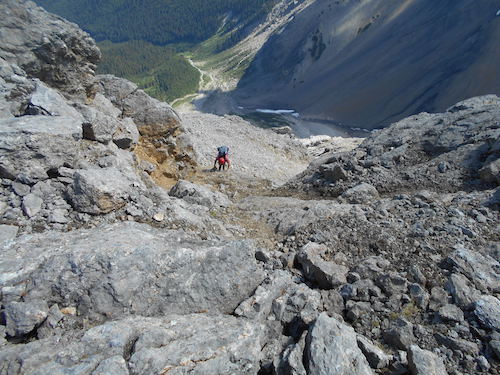
Descending
the far edge (climber's left) of the face. |
|
|
 |
|
|
Moderate
scrambling.
|
|
|
 |
|
|
Steep
but quite manageable.
|
|
|
 |
|
|
Leaving
the summit block behind.
|
|
|
 |
|
|
Weather
moves in as we travel the south-east ridge.
|
|
|
 |
|
|
Almost
back at the saddle.
|
|
|
 |
|
|
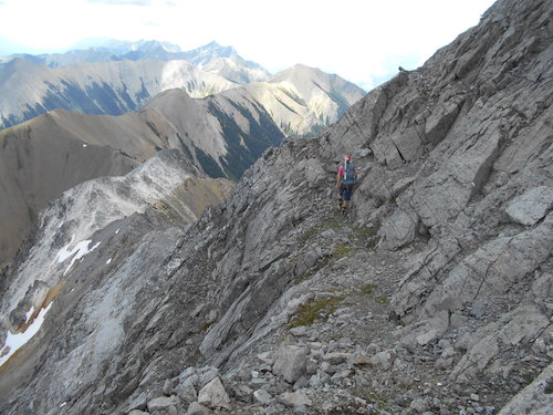
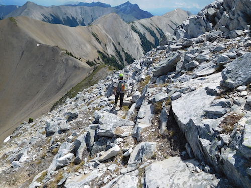
A
steep bit interrupts the ridge.
|
|
|
 |
|
|
Pleasant
trek to the basin below.
|
|
|
 |
|
|
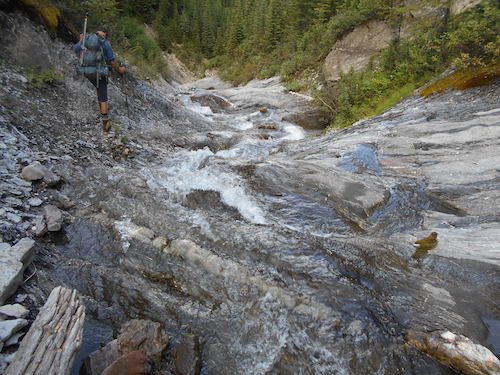
In
the creekbed for the remainder of the hike.
|
|
|
 |
|
|
Happy
trails!!
|
| Back
to home page |
|
|